Zakynthos is an island of dramatic contrasts. While it might look small on a map, the reality of driving here is a different story, especially when you start analyzing real Zakynthos driving distances instead of just glancing at kilometers. Between the winding mountain switchbacks of the west and the hidden coastal roads of the north, a 20-kilometer stretch can easily turn into a 40-minute adventure. That is why understanding true Zakynthos driving distances is essential before planning your daily routes.
This guide is designed to take the guesswork out of your itinerary by breaking down realistic Zakynthos driving distances between the island’s major spots. Whether you are navigating a rental car for the first time or you’re a seasoned traveler trying to optimize your fuel budget and schedule, knowing accurate Zakynthos driving distances helps you plan smarter. No more “are we there yet?” moments. No more underestimating mountain curves or scenic detours. Just smooth, well-timed transitions from one breathtaking view to the next, guided by real, practical Zakynthos driving distances you can rely on.
What we’ll cover for every route
To help you build a bulletproof plan, I have broken down each major route using four key metrics:
Approximate distance: The total mileage, so you can estimate your fuel consumption.
Estimated driving time: Realistic durations that account for narrow roads, summer traffic, and the occasional local tractor.
Hidden gems along the way: Recommendations for traditional villages (like Loucha or Giri), scenic pull-offs, and authentic tavernas you might otherwise blink and miss.
Google Maps verification: Quick links to verify live traffic and save locations directly to your device.
Beyond the logistics, you’ll find integrated links to my other specialized guides, covering everything from finding the best sunset photo spots to navigating beach parking without the stress.
Zakynthos may look compact on the map, but distances matter when you start planning scenic routes, beach days, sunsets, mountain villages, and viewpoint stops. Many travelers underestimate how long it takes to reach a destination because Greek island roads can be winding, narrow at times, and slower than main highways.
This article will help answer key questions like:
How far is it from Zakynthos Town to Navagio (Shipwreck) Viewpoint?
How long does it take to drive from Tsilivi to the Blue Caves?
What is the drive time from northern points like Skinari to Keri Lighthouse in the south?
As you read, I’ll use Zakynthos Town as a starting reference point for example routes, because it is central and where many visitors begin their days, especially if flying into Zakynthos Airport (ZTH) or staying in nearby resorts. If you want to get deeper into overall travel planning, check out the Zakynthos travel checklist: Flights, accommodation & the perfect rental car for a full step-by-step guide.
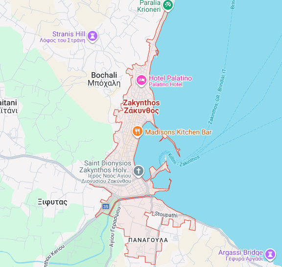
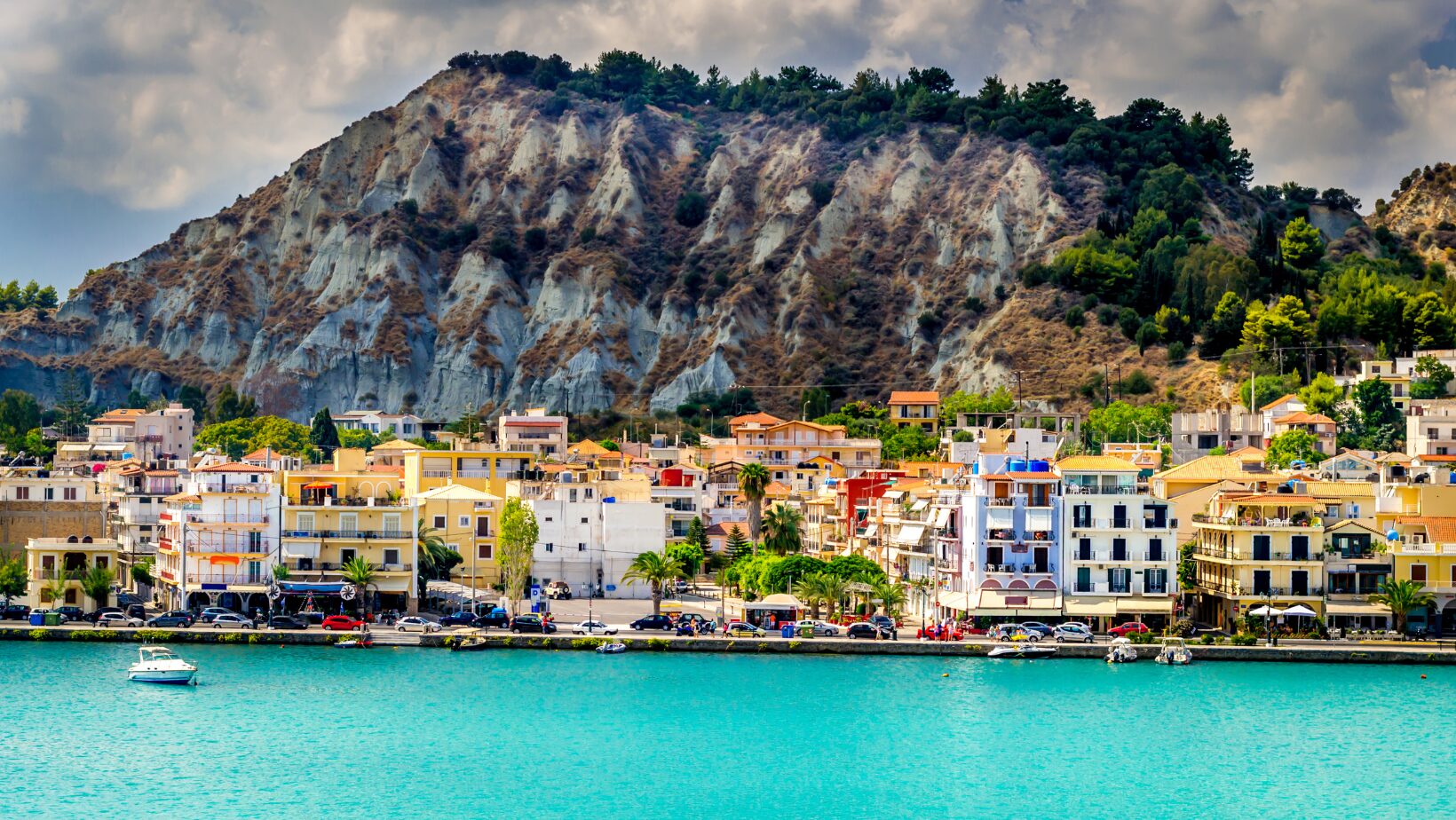
1. Zakynthos Town as the central reference point
Zakynthos Town (also known as Zante Town) is the administrative, commercial, and transportation hub of the island. Geographically, it sits on the eastern coast, roughly at the midpoint between the northern and southern ends of Zakynthos. Because of this position, it naturally functions as the most practical reference point when estimating real driving times between major attractions.
Most visitors pass through Zakynthos Town at some stage of their trip. The international airport (Zakynthos International Airport – ZTH) is located just 4-5 km south of the town center, meaning that within 10-15 minutes of landing, many travelers are already driving away in their rental car. If you’re still deciding whether to rent, you may want to read 10 Essential reasons to rent a car in Zakynthos, as distances on the island are manageable, but public transport is limited.
Most visitors pass through Zakynthos Town because:
The airport (ZTH) is only 4–5 km away
The main ferry port to Kyllini is located here
It offers supermarkets, fuel stations, banks, and pharmacies
It connects easily to both northern and southern routes
From Zakynthos Town, you can reach almost any major attraction within 30 to 75 minutes. That’s why using it as a baseline makes understanding Zakynthos driving distances much easier. Because of its infrastructure and road connectivity, Zakynthos Town connects easily to the island’s main north-south road axis. From here, you can head north toward Tsilivi, Alykes, and Skinari, or south toward Laganas, Keri, and Gerakas.
All driving times below are calculated under normal conditions (non-peak traffic, dry weather, average driving pace). In high season (July-August), you should always add 10-20% extra time, especially for popular viewpoints.
For every route, the approximate distance, the estimated driving time, and exactly what can be seen along the way are explained. Links are also included where these routes can be verified on Google Maps, along with other relevant articles from the blog that assist in planning photo stops, beach days, and more.
2. North Coast Zakynthos driving distances
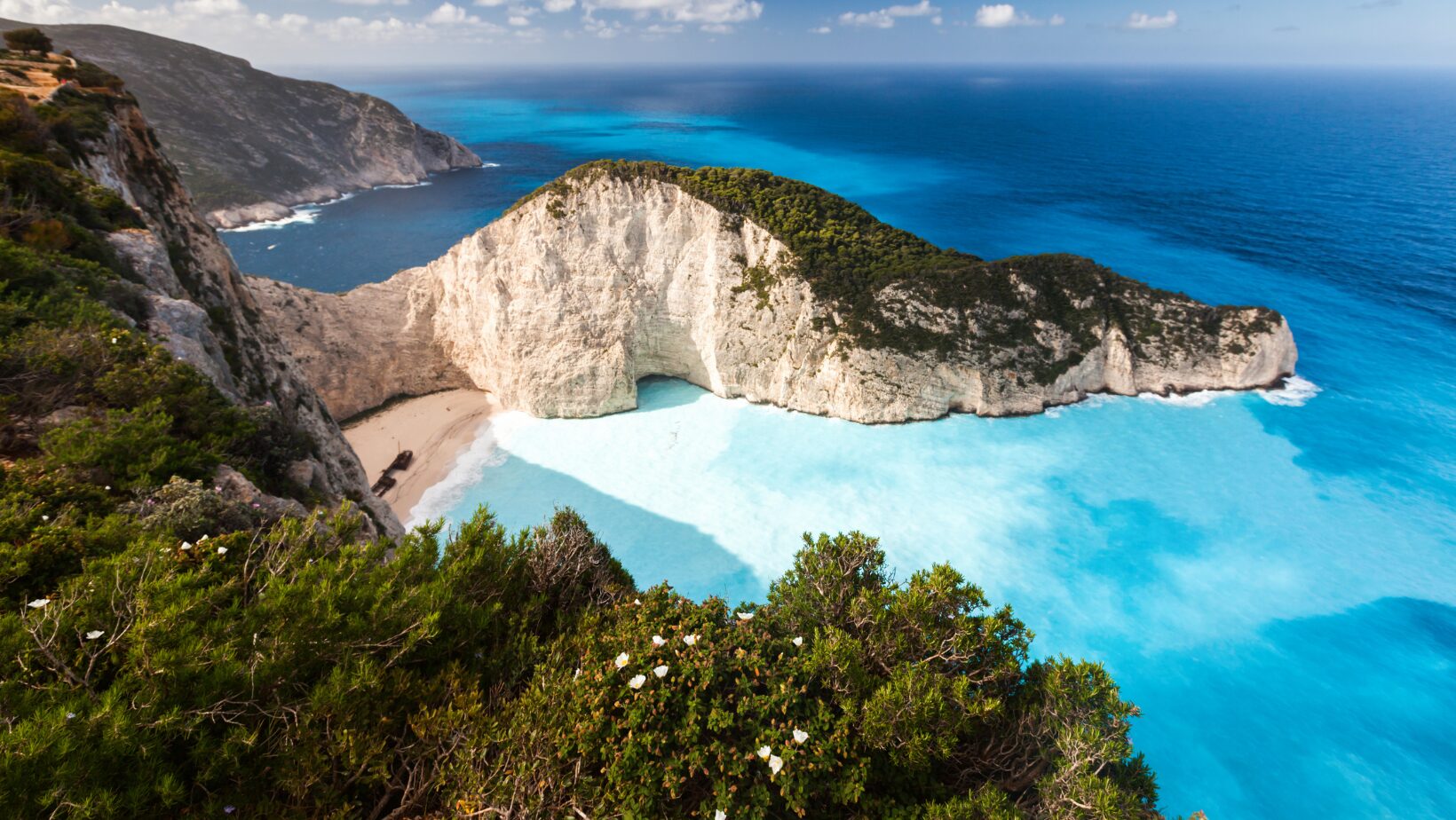
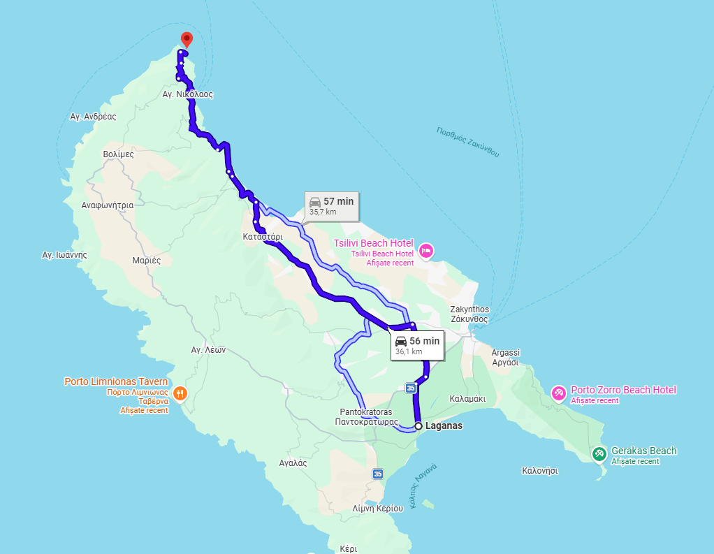
Zakynthos Town to Navagio Viewpoint
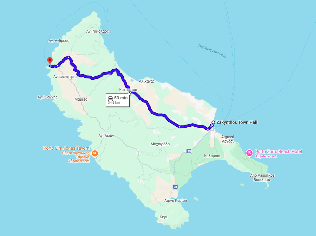
Distance: ~35 km
Estimated Time: 50–60 minutes
What to see: The mountain villages of Volimes and Anafonitria.
This is one of the most searched Zakynthos driving distances. The route passes through inland villages like Machairado and Anafonitria before reaching the final mountain section toward the viewpoint.
Important notes:
The final 10–15 km include tighter curves.
Midday traffic increases in July and August.
Parking areas fill quickly in peak season.
Even though Google may show 65 minutes, realistic Zakynthos driving distances in summer can reach 75–85 minutes. For parking tips and hidden angles, read: Navagio Beach in Zakynthos by car: Discover hidden viewpoints and parking secrets
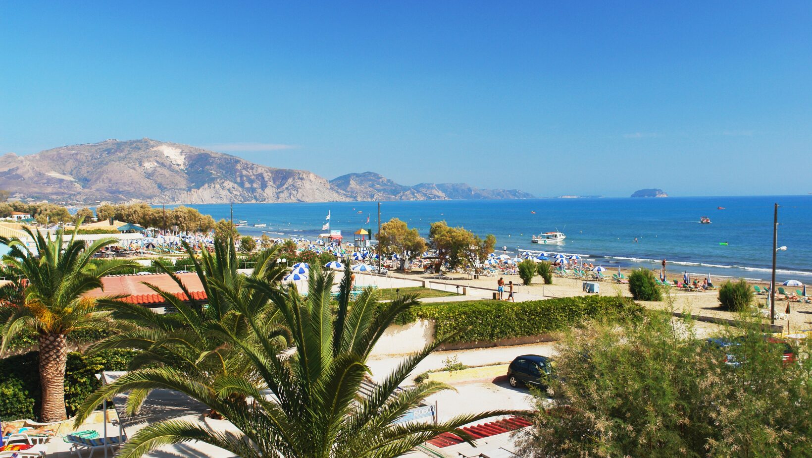
Zakynthos Town to Tsilivi Beach
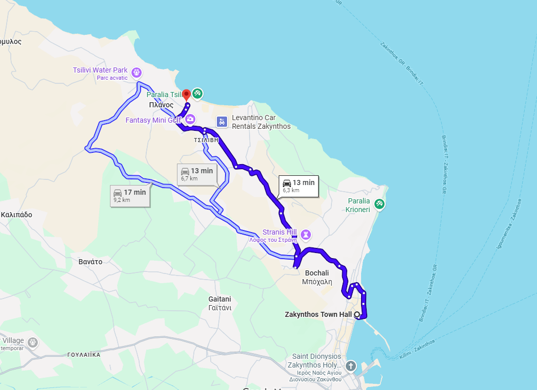
Distance: ~7 km
Estimated Time: 15 minutes
What to see: Coastal views and the outskirts of the Venetian Castle.
Zakynthos Town to Skinari Lighthouse
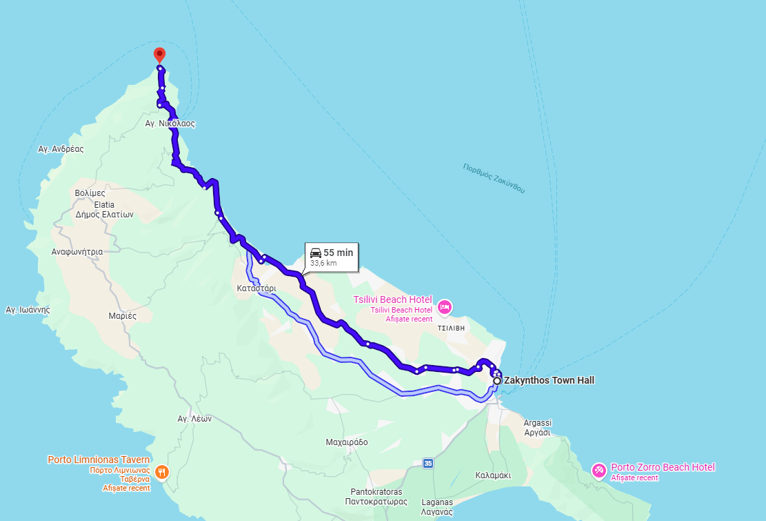
Distance: ~33 km
Estimated Time: 55 minutes
What to see: The port of Agios Nikolaos and the northern rugged coastline.
3. South Coast Zakynthos driving distances
Zakynthos Town to Keri Lighthouse
Distance: 22 km
Estimated time: 45–50 minutes
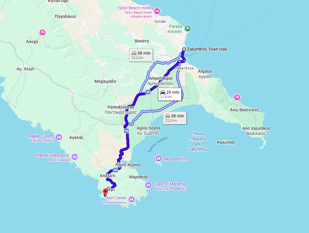
One of the most beautiful southern Zakynthos driving distances. The first section is relatively flat toward Laganas. The final stretch becomes gently winding as you approach the cliffs of Keri.
Sunset hours may increase travel time slightly.
Zakynthos Town to Gerakas Beach
Distance: 18–20 km
Estimated time: 30–35 minutes
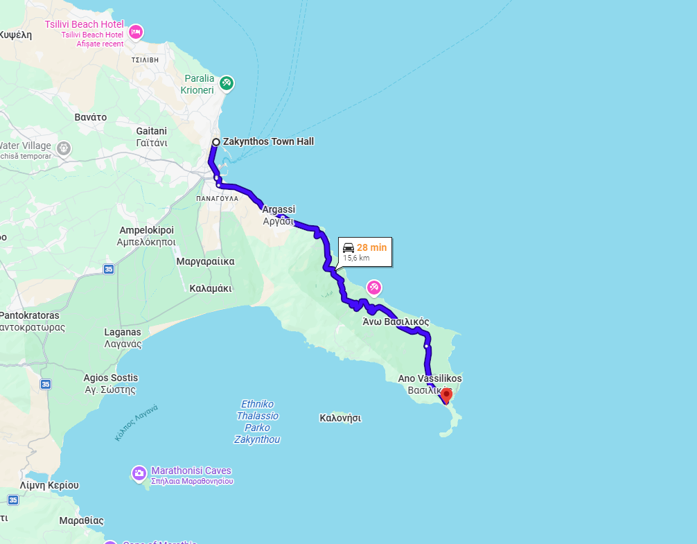
Located inside the National Marine Park, Gerakas Beach is easier to reach than northern attractions. This is one of the more straightforward Zakynthos driving distances, with smooth roads and fewer curves. Expect turtle nesting zones and organized beach areas.
4. Cross-Island Zakynthos driving distances
Many travelers do not stay in Zakynthos Town. They stay in Tsilivi, Laganas, or Alykes. Understanding cross-island Zakynthos driving distances is therefore essential.
Tsilivi to Navagio Viewpoint
Distance: 50–55 km
Estimated time: 70–90 minutes

Full northwestern route with mountain curves.
Laganas to Blue Caves
Distance: 55–60 km
Estimated time: 80–95 minutes
Crosses almost the entire island from south to north.
Alykes to Keri Lighthouse
Distance: 40–45 km
Estimated time: 70–90 minutes
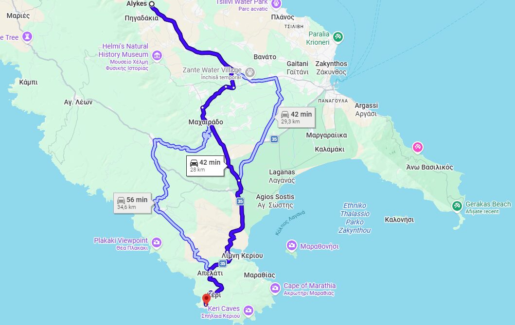
A full cross-island drive from the north coast to the southwest cliffs. These longer Zakynthos driving distances are best planned as full-day routes.
5. Why Zakynthos driving distances feel longer than they are
On paper, Zakynthos looks compact. A glance at Google Maps may show 35 or 40 kilometers between two points. However, real-life Zakynthos driving distances often feel longer than they appear. This is not because the island is large, but it’s because of how the terrain shapes the road network.
First, the western and northern parts of the island are mountainous. Roads climb gradually, curve around hills, and descend toward the coastline. Mountain switchbacks are common, especially on routes toward Navagio Viewpoint, Porto Limnionas, and Skinari Lighthouse. While these roads are paved and maintained, they naturally reduce average driving speed.
Second, many inland villages were built centuries ago, long before modern vehicles. As a result, narrow village roads are part of the driving experience. In places like Volimes or Anafonitria, streets can briefly narrow, requiring slower navigation and occasional courtesy stops.
Third, during peak summer months, tourist buses operate on the same roads as rental cars. When a bus climbs a curved mountain section, traffic behind it adjusts accordingly. This does not create major delays, but it does influence realistic Zakynthos driving distances in terms of time.
Summer traffic also plays a role. Popular routes, especially between 11:00 AM and 4:00 PM, can slow slightly near beach entrances or viewpoint parking areas. Even finding a parking space can add 5-10 minutes to your journey.
Then there are scenic stops. Zakynthos is full of unexpected photo pull-offs. Drivers often stop briefly to admire cliff views, olive groves, or sunset light. These pauses are part of the island’s charm, but they extend travel time.
Finally, rural life is still present. You may encounter a tractor, a small farm vehicle, or even goats crossing a hillside road. These moments are rare but entirely normal on a Greek island.
Because of all these factors, a 40 km route rarely equals 40 minutes. A more realistic expectation for Zakynthos driving distances is to add a 10-15% buffer to whatever Google Maps suggests, especially in July and August. Planning with this mindset transforms your trip from rushed to relaxed.
6. How to plan realistic day trips
One of the most common mistakes visitors make is underestimating Zakynthos driving distances and trying to combine too many far-apart attractions in one day.
For example:
Navagio Viewpoint + Blue Caves + Keri Lighthouse in one single day may look manageable on a map. In reality, this plan requires driving from northwest to northeast and then all the way to the southwest coast. You would spend more time in the car than enjoying the scenery. Instead, divide the island logically based on Zakynthos driving distances.
North Coast day
Navagio Viewpoint + Porto Limnionas
Optional: Anafonitria Monastery or a stop in Volimes
This route keeps your driving focused in one region, minimizing backtracking.
South Coast day
Keri Lighthouse + Marathonisi boat trip
Optional: Sunset near Kampi
This plan groups southwest highlights together, keeping your total daily Zakynthos driving distances reasonable.
Town & East Coast day
Bochali Viewpoint + Tsilivi Beach + Zakynthos Town sunset
This is a lighter driving day, ideal after a long north-coast excursion. When you divide the island this way, your daily Zakynthos driving distances remain balanced. You avoid exhaustion. You allow time for meals, swims, and spontaneous stops. That’s the difference between “covering the island” and actually enjoying it.
The short answer is yes, Zakynthos is easy to drive, provided you remain attentive and calm. Most main roads are paved, clearly marked, and in good condition. The island does not have high-speed highways, which naturally keeps driving relaxed. Speed limits are moderate, and traffic outside peak season is light.
Mountain routes require attention because of curves and elevation changes, but they are manageable for any driver with standard confidence. Even longer Zakynthos driving distances feel comfortable if you approach them at a steady pace.
If you are unsure about transmission choice, especially on hill routes, read our article about: Automatic vs. manual in Zakynthos. If you prefer higher ground clearance for rural or cliffside access roads, you may also explore the Best SUVs for the Zakynthos trip. The key to comfortable exploration is not speed. It is realistic planning based on real Zakynthos driving distances.
Zakynthos is not a large island. Yet terrain, curves, and seasonal traffic all influence real Zakynthos driving distances. While most major attractions are within 30 to 75 minutes of each other, that time can feel longer if you underestimate mountain routes or attempt to cross the island multiple times in one day.
Understanding true Zakynthos driving distances allows you to:
Create balanced, logical itineraries: When you know the real driving times, you can group attractions by region and avoid unnecessary backtracking across the island.
Avoid exhausting cross-island drives: Realistic Zakynthos driving distances help you prevent overloading one day with too many far-apart locations, reducing fatigue and stress.
Calculate fuel usage accurately: By estimating how many kilometers you will actually drive, you can predict fuel consumption more precisely and plan your budget with confidence.
Choose the right rental vehicle: Knowing your expected Zakynthos driving distances makes it easier to decide whether a compact car is enough or if a more comfortable automatic or SUV would suit your route better.
Travel confidently without rushing: When you understand true travel times, you leave at the right moment, avoid pressure, and enjoy each stop without constantly checking the clock.
Before finalizing your reservation, we recommend that you first explore our fleet, so you can compare vehicle categories and select the model that best matches your travel plans and expected Zakynthos driving distances. In addition, it is important to carefully review the available insurance options, as choosing the right coverage will give you confidence and peace of mind while exploring the island. Furthermore, if you are traveling with children, extra luggage, or planning longer scenic routes, you should take a look at the extras section to enhance comfort and flexibility during your trip. To clarify any practical concerns in advance, you can also consult our FAQs, where we provide clear answers about fuel policy, deposits, pickup procedures, and local driving guidelines. Finally, before confirming your booking, make sure to read the terms & conditions, so you fully understand the rental policies and responsibilities, ensuring a smooth and transparent experience from start to finish.
With smart planning and realistic expectations about Zakynthos driving distances, the island becomes simple to navigate, flexible to explore, and incredibly rewarding. Because in Zakynthos, it’s not about how far everything is, it’s about how wisely you plan the distance.